WIEN
CATEGORY
Urban & Architectural
SITE'S FAMILY
How to Use New Inputs to Change Urban Space?
TEAM REPRESENTATIVE
Architect or Urban designer (Architect - Urban planner - Landscaper)
LOCATION
Wien Kagran - Donaustadt - Österreich
POPULATION
City 1.765.00 inhabitants
STRATEGIC SITE
24 ha
SITE OF PROJECT
7 ha
SITE PROPOSED BY
City of Wien
OWNER(S) OF THE SITE
City of Wien and others
COMMISSION AFTER COMPETITION
Urban project management role,design of public and landscape areas.
Detailed information / Registration:

INTENSIFYING VIENNA’S SECOND CENTER
THE PUBLIC AXIS FROM THE KAGRAN UNDERGROUND RAILWAY STATION TO SCHRÖDINGER PLATZ ADDRESSES A PROFOUND TRANSFORMATION OF PUBLIC SPACE AND ITS PLAYERS. THE THEME OF THE PUBLIC SPACE CULMINATES IN SCHRÖDINGER PLATZ, WHERE INDOOR AND OUTDOOR SHOPPING, ADULT EDUCATION CENTER, EVENT CENTER, HOUSING AND LEISURE FACILITIES ARE TO BE DEVELOPED INTO A NEW URBAN CENTER WITH CONVINCING QUALITIES FOR A VARIETY OF DIFFERENT PLAYERS.
DIE ÖFFENTLICHE ACHSE VON DER U-BAHNSTATION KAGRAN BIS ZUM SCHRÖDINGER PLATZ ADRESSIERT EINE TIEFGREIFENDE TRANSFORMATION DES ÖFFENTLICHEN RAUMS UND SEINER AKTEURE. DAS THEMA DER ÖFFENTLICHKEIT KULMINIERT AM SCHRÖDINGER PLATZ: DORT SIND INDOOR- UND OUTDOOR-SHOPPING, VOLKSHOCHSCHULE, VERANSTALTUNGSZENTRUM, WOHNEN UND FREIZEITEINRICHTUNGEN ZU EINEM NEUEN URBANEN ZENTRUM MIT ÜBERZEUGENDEN QUALITÄTEN FÜR UNTERSCHIEDLICHSTE AKTEURE ZU ENTWICKELN.
HOW THE SITE CAN CONTRIBUTE TO THE ADAPTABLE CITY?
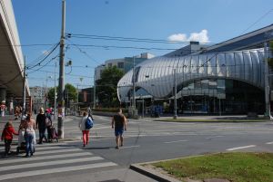
Kagran-Centre shall be the incarnation for Vienna’s ambition to turn the historical figure of a core town to a vibrant polycentric metropolis. The place is an assembly of disparate elements around an intermodal hub: Danube Centre (DC) is Vienna’s largest mall, sports-centers, education-facilities, district office, parking areas and single family-homes. Heavy transformation is ongoing: Forum Donaustadt, a huge mixed use high rise development will integrate citizen services, offices, hotel and housing; two large building-complexes shall be replaced; two tramway lines were recently rerouted and extended; The Danube Centre is under continuous process of adaptation. How can Europan transform the public spaces along the East West axis of Kagran, adapting mobilities, building-skins, green spaces and urban facilities to an indigenous urbanity for Kagran being Vienna´s second center?
CITY STRATEGY
In 2029 Vienna-city will pass the amount of 2 million inhab., due to an annual growth of more than 20.000 people. To manage this intense growth the city focuses on various scenarios of densification: the activation of reserves in the inner city (e.g. the development of railway station areas), the planning of large satellite towns (Seestadt Aspern) and the support of polycentric growth with the extension of the public transport network. Donaustadt is Vienna’s fastest growing area. For its main center, Kagran (Europan site), the city has been commissioning over the past years numerous projects (studies, think tanks, competitions). Nevertheless, Kagran still lacks an overall concept for its identity, a comprehensive urban-design-strategy, creating out of this impressive amalgam of disparate elements a distinctive identity, a contemporary urban centre through a unique performance of its public spaces.
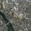
SITE DEFINITION
The Wagramer Strasse is the most important radial axis with the Stephansdom at its vanishing point passing through UNO-City, Donaucity (w. DC-tower of D. Perrault), Praterstern (traffic hub with the Giant Wheel), Schwedenplatz (w. J. Nouvel’s Sofitel). The city wants to continue this pearl-chain, making Kagran a unique public hub with intense urban life and a manifold offer of amenities over 24 hours. The Europan site deals with the development of the main East-West-road of Kagran, stretching from the subway stop in the west to Schrödinger Platz in the east. The 60 meters wide road lacks urban life due to closed facades (shopping mall, fenced off single family homes), the barrier of Wagramer Strasse and the organization of traffic which heavily disadvantages the sphere of soft mobility, as well it ignores the road’s potential to become a place to stay, connecting the subway with the eastern pole.
FUTURE OF THE SITE IN RELATION OF SITE´S FAMILY AND ADAPTABILITY
The East-West road shall convert to a public space dedicated to the pleasures and potentials of slow motion. This includes several layers of intervention for the urban strategy:
*TURN CLOSED AREAS TO INTERFACES
How to address the potentials of the city´s largest shopping mall, turning its back to the city´s outdoor spaces? How to address single-family homes behind billboard-fences?
*CONSIDER THE POTENTIAL OF UNBUILT AND LEFT OVER SPACES
Green strips, crossing points, parking areas and unused lanes provide extended surface areas for the development of public space.
*REORGANIZE THE TRAFFIC-FLOW IN ORDER TO GAIN SPACE FOR INTERVENTIONS
On a long term, intelligent interventions in the logistics of the traffic flow shall be considered in order to gain space for different activities.
*INTRODUCE EQUIPMENT
Such as furniture, signs, green elements, crossing devices and kiosks in order to enhance the attraction of the area as public space.


